Hike to High Knob Fire Tower
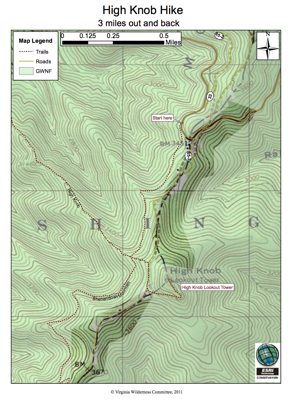
|
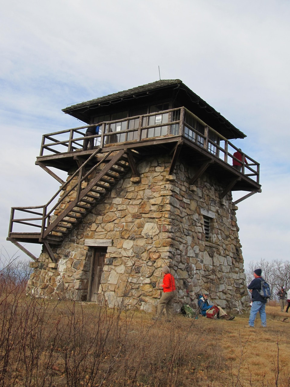
Hikers exploring the historic tower. Photo by Don Blume
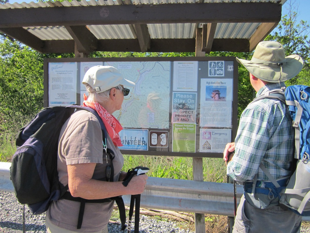
Kiosk at the trailhead in the parking lot on the crest of Shenandoah Mountain, WV side. Photo by Lynn Cameron
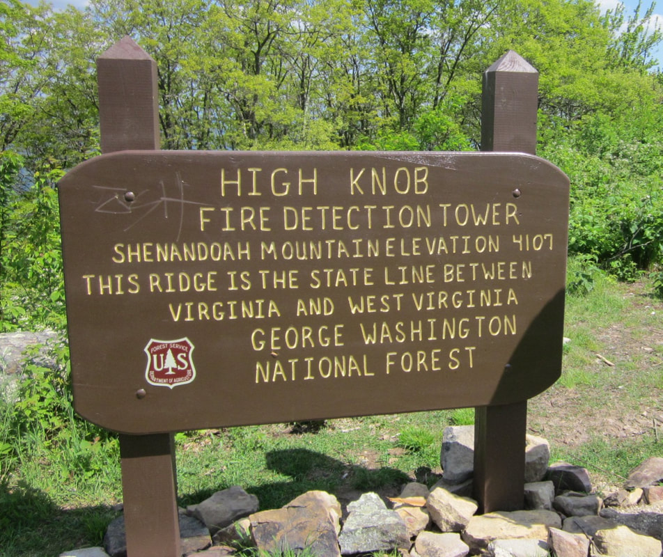
Sign by the Fire Tower. Photo by Lynn Cameron
|
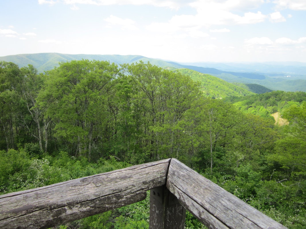 View of Bother Knob, Flagpole Knob, and Reddish Knob to the south. Photo by Lynn Cameron
The 360-degree visibility from High Knob Fire Tower includes:
- To the North:
- The Northern third of Shenandoah Mountain
- Cow Knob – About 10 miles away, another fire tower used to stand here.
- Clearings and Meadows – These were developed by private sportsmen groups as wildlife food clearings.
- US Highway 33.
- To the East:
- A 30,000 acre National Forest watershed that is part of the proposed Shenandoah Mountain National Scenic Area, including Skidmore Fork and Dry River
- Railroad Hollow – said to have been surveyed by the Chesapeake-Western Railroad as the potential location of a tunnel through the mountain. The tunnel would have been part of a route connecting Washington, D.C. to St. Louis, MO
- Site of Liskey House – an overnight stage stop on the wagon road between Harrisonburg and Franklin, WV
- Switzer Lake – a 100-acre water source for Harrisonburg
- Harrisonburg, Massanutten Peak, and the Blue Ridge Mountains
- To the South:
- Open fields on private land on the crest of Shenandoah Mountain
- The vast expanse of the proposed 90,000-acre Shenandoah Mountain National Scenic Area
- Reddish Knob, the highest point on Shenandoah Mountain – about 9 miles away. A fire tower stood here until 1975
- 1,400 acres of old growth forest at Skidmore Fork, which is proposed for Wilderness designation
- Radio communication station utilized by the United States Navy at Sugar Grove, WV
- To the West:
- Brandywine Lake Recreation Area in the George Washington National Forest
- Community of Brandywine, WV
- The Allegheny Front mountain formation and Spruce Knob, highest point in West Virginia