Threats to Shenandoah Mountain
|
Shenandoah Mountain area faces a number of serious threats that could have major impacts on the beauty and health of the area. National Scenic Area and Wilderness designation would protect Shenandoah Mountain’s wild heritage and maintain this unique, natural area.
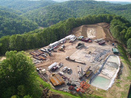
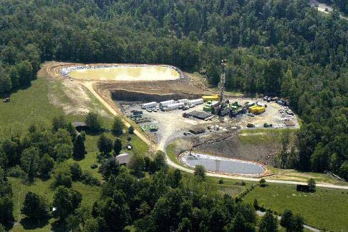
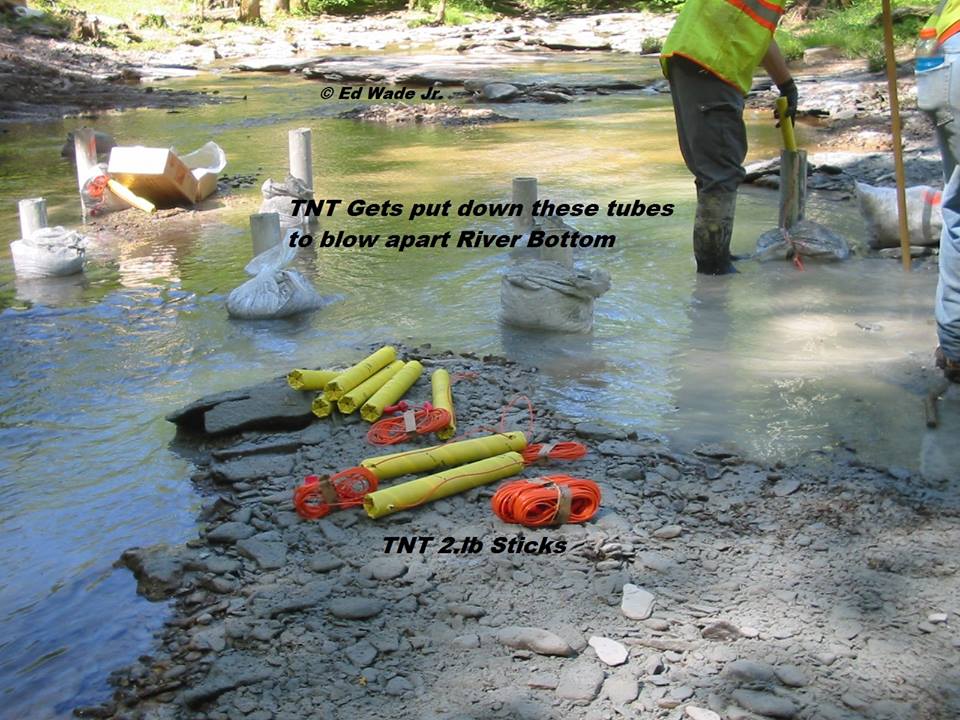
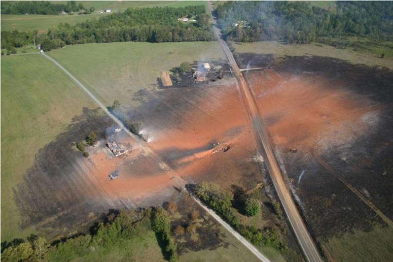
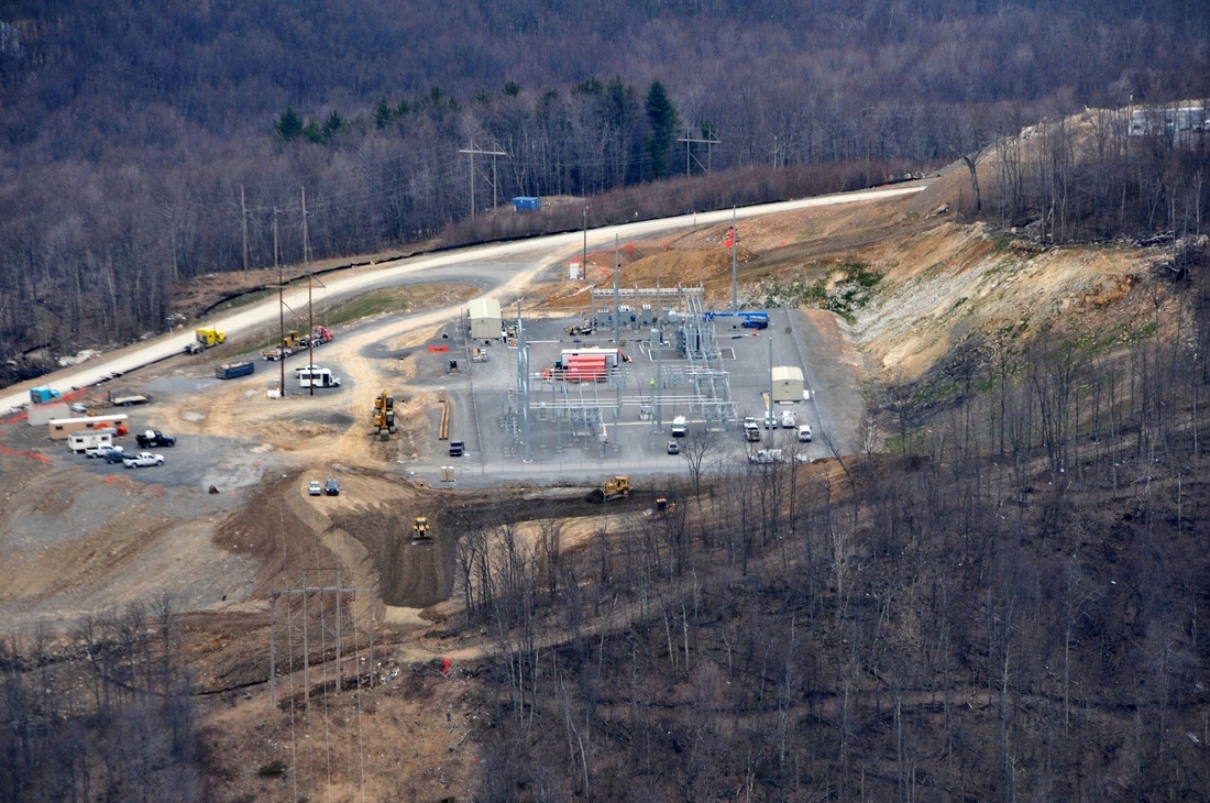
Hydrofracking Gas Development Shenandoah Mountain and Laurel Fork are both underlain by Marcellus Shale, the geological formation that has natural gas that is now recoverable through hydrofracking. Hydrofracking involves drilling vertically and then horizontally into the shale layers and pumping several million gallons of water, sand and chemicals under pressure to fracture the shale and release the natural gas. Numerous proprietary chemicals, including diesel fuel which contains benzene and other known carcinogens, are used in hydrofracking. There is widespread concern that these chemicals can make their way into both surface and ground water, thereby endangering our public water supply, private wells, and aquatic resources. The Federal Bureau of Land Management leases minerals and gas under national forest land. In 2007-2008, two special areas in the George Washington National Forest were leased for gas for a 10-year period with the option to renew. One of these,10,000-acre Shaws Ridge, lies directly west of Ramseys Draft Wilderness in Highland County. If a leased area is developed, permanent access roads would be constructed, pipelines would be laid, and wells would be drilled. The wild character of the area would be lost forever. National Scenic Area or Wilderness designation of an area could make our most special places, like Shenandoah Mountain and Laurel Fork, off limits for gas development. 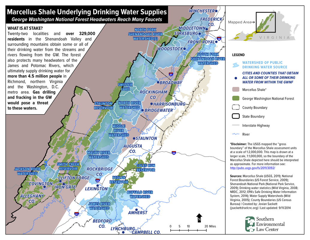
Drinking water supplies for Staunton, Harrisonburg, and Bridgewater are underlain by Marcellus Shale. Hydrofracking in the GWNF would endanger our critical watersheds. Map courtesy of SELC.
Road Building
Roads built in forests fragment sensitive habitat for plants and animals, cause soil erosion, affect water quality, introduce invasive species that outcompete native ones, and degrade the overall wild character of the forest. Shenandoah Mountain is currently one of the least fragmented areas in the Eastern United States. Let's keep it that way! Impact of Roads on Birds Cutting roads (or housing lots, or windmill sites, or ski trails or.....) through large blocks of forest reduces nesting success of several species of birds, including wood thrushes, ovenbirds, Acadian flycatchers and various warblers. The "edge" created by road-building gives the brown-headed cowbird - which is not a deep-forest bird - access to formerly intact forests where the named species nest. Brown-headed cowbird is a nest parasite, laying its eggs in the nests of other birds. Cowbird hatchlings will push the host nestlings and eggs out of the nest. Forests fragmented by roads also give avenues of attack to nest predators such as raccoons, opossums, blue jays and crows. A study by Hawk Mountain Sanctuary showed that wood thrushes nesting within blocks of several thousand acres had 70% nesting success; those in 200 acre fragments were 50% and in 50-acre patches, success was about 30%. (Source: Mountains of the Heart: A Natural History of the Appalachians by Scott Weidensaul.1994) 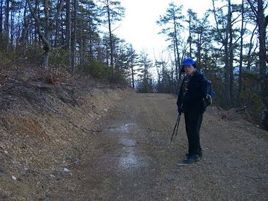
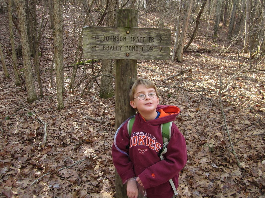
New road on Hankey Mountain
Logging
The eastern national forests were created in response to the Weeks Act of 1911 which permitted the purchase of "forested, cut-over or denuded lands within the watersheds of navigable streams..." deemed "necessary for the regulation" of their flow. In 1924, the Clarke McNary Act added "the production of timber" to the purpose of national forest acquisition. (The Origins of the National Forests Harold K. Steen, Ed.1992) Today's eastern national forests bear little resemblance to the lands that were purchased nearly one hundred years ago, which is a tribute to the efforts of government conservationists and the resiliance of the forest resource. Even so, there is not a great quantity of good quality timber available for harvest. This is especially true on the steep, rocky slopes that characterize the Shenandoah Mountain area. Friends of Shenandoah Mountain realizes that logging may be appropriate on lower-elevation areas, for timber harvest and wildlife management, with best management practices strongly enforced to prevent watershed damage and the incursion of invasive exotic plants. Friends of Shenandoah Mountain sees a higher and longer-term value to the core forested areas of Shenandoah Mountain in their intact preservation for wildlife, recreation and watershed protection. |
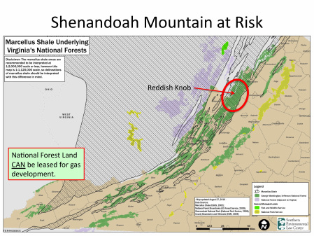
Most of Shenandoah Mountain is underlain by Marcellus Shale
Dominion Natural Gas Pipeline
In May 2014, Dominion Resources proposed a 42" interstate natural gas pipeline through the Monongahela and George Washington National Forests to connect gasfields in West Virginia to markets in North Carolina. This would be the largest pipeline ever built in Virginia. The proposed route crosses near our Shenandoah Mountain National Scenic Area proposal. This is just the type of high impact heavy industrial development that scenic area and wilderness designation prevents. The proposed route would:
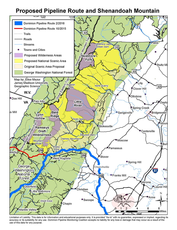
This map, developed by JMU GIS major, Nathaniel Morrison, shows the Dominion pipeline route over Hankey Mountain.
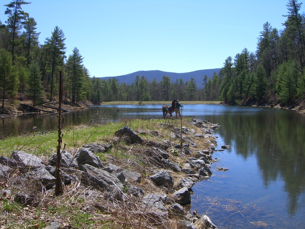
If approved, the pipeline would create a permanent linear clearing across the Braley Pond area and Hankey Mountain that would be a pathway for invasives. Trees would not be allowed to grow in this area again. The 150' construction swath and permanent 53' swath would fragment the national forest, creating "edge effect", which favors nest predators like the cowbird. It would also permanently degrade the Braley Pond recreation area, which is popular for hiking, mountain biking, fishing, hunting, camping, and picnicking. Construction would degrade native brook trout streams, like the Calfpasture River, which flows off Shenandoah and Hankey Mountains.
Learn more about how the ACP could affect the proposed Shenandoah Mountain National Scenic Area. Commercial Wind Facilities
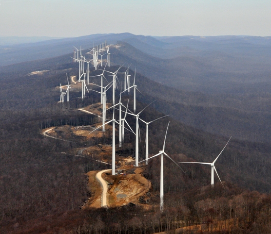
The Friends group recognizes the need to shift to renewable energy sources for producing electricity in the United States. The environmental benefits of moving away from fossil fuels, nuclear power and other common sources of generating electricity are numerous and significant; however, the siting of large-scale wind turbines on Shenandoah Mountain would have enormous ecological, recreational, and cultural implications. 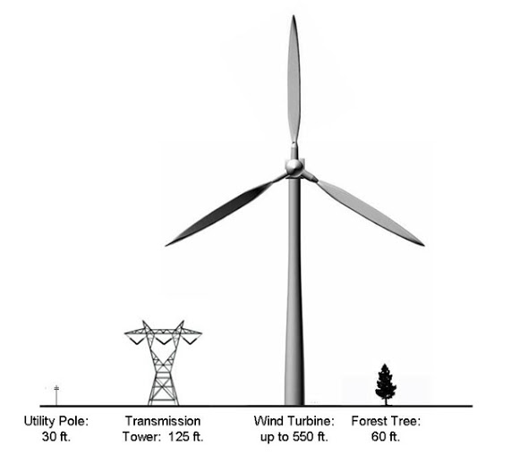
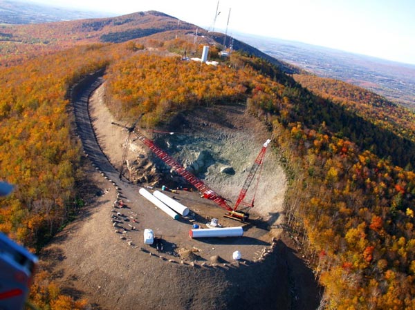
Why is wind development bad for Shenandoah Mountain?
Industrial wind developers are asking for permits in the Shenandoah Mountain area. Rockingham County Board of Supervisors granted a permit for a metereorological tower on private land on Shenandoah Mountain in December 2008. Permit applications on national forest land are expected. Designation of Shenandoah Mountain as a National Scenic Area with core areas as Wilderness would prevent industrial wind development in this special place. |